Wednesday, August 28, 2013

Larch Valley and Sentinel Pass Hike

We were supposed to hike Castle Mountain last weekend, but we were turned away from the trailhead due to a bike race through Johnston Canyon. Jim being the mountain man that he is quickly came up with plan B, and we headed to Lake Moraine to hike Larch Valley and Sentinel Pass. We were disappointed that we couldn't hike Castle Mountain since it's one of the iconic hikes in the Banff area. We may have to wait until next summer if we don't fit it in before winter (just around the corner).

The hike started at Moraine Lake and headed straight up a set of switch backs where we gained 350 m (1148 ft) in 2.6 km (1.6 miles). The trail continues to the Larch Valley and Minnestimma Lake another 8 km (5 miles). From here, there's an amazing view of eight of the 10 Wenkchemna peaks, as well as the Fay Glacier. Now this is where the going gets tough. We headed up a slippery talus and scree trail to Sentinel Pass another 6/10 of a mile (every 10th of a mile counts when you are climbing up hill!) The final elevation  gain was  725 m (2379 feet). At 2611 m (8566 feet), Sentinel Pass is one of the highest maintained passes in the Canadian Rockies. The views are indescribable as you top over the crest and see Paradise Valley on the other side of the pass and the rock pinnacles just below. Some rock climbers with " mucho grande cojones" were scaling the pinnacles the day we were there. I hope you can make them out in the pictures. I'll let you be the judge, but you'll be hard pressed to find views any more spectacular than these!

The start of the hike looking back at Moraine Lake

Sentinel Pass, center of picture

Our destination is Sentinel Pass, the low point in the middle of the picture.

Fay Glacier in the background, me in the foreground (he he)

Minnestimma Lake

The long and winding road heading up to the pass


Eight of the 10 Wenkchemna Peaks

Paradise Valley


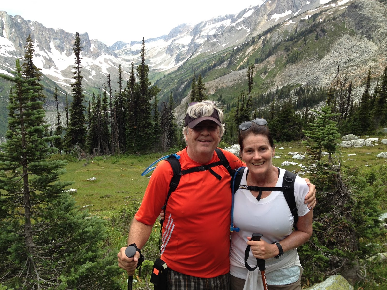
Me and Jim on the top of Sentinel Pass

The rock climbers are on the top 50% of the pinnacle on the right side. Zoom in!

Mountain man, Jim

Another view of the pinnacles

It was windy and cold up there!


Fay Glacier

Yours Truly

Okay, Jim, that's it, back up just a little more....


And finally, no day would be complete unless you saw some guy wearing his grandma's afghan. 

Monday, August 12, 2013

Hike to Baldy Pass

This past weekend was beautiful, sunny and a high of 80 F. Just perfect for a hike to Baldy Pass. Baldy Pass is in Kananaskis Country, which has seen quite a few of it's trails devastated by the spring floods. The trail head starts at Baldy Parking lot near Barrier Lake on Highway 40. The hike is a popular half day hike that is 8 km (5 miles) round trip. There is an elevation gain of 575 m (1,886 ft.). The trail was washed out at some points and the bridge crossings were washed away. I have posted a couple of pics of what the trail looked like before the flood. We enjoyed enhanced views of the valley and ski area by scrambling up the Lusk Pass trail for about 1 km.


Here I am at the top of Baldy Pass Trail

As we climbed higher to get better views, we saw people scrambling up Lusk pass just under the rocky point on top. We decided to head over that direction.

The views opened up as we got higher. You can see the Nakiska ski area in the background.

The Kananaskis valley in the background. That is a steep cliff, my friend...

We scrammbled up these rocks to get to the top. Going up was okay. Coming down was not so easy.....

Taking a rest.

Looking across to the other side, our first climb towards Mt Midnight.

Flooding damage to the trail. The next picture is the way the trail looked in 2009.

The trail in 2009.

More flood damage. The bridges and paths along the river bed were wiped out.

This picture show the trail along the left side in 2009.

No more trail in 2013.


Thursday, August 8, 2013

Hiking in Yoho and Glacier National Parks

Jim and I celebrated August Long holiday by hiking in BC's national parks. The holiday is a civic holiday known loosely as August Long, and each municipality that opts to declare this holiday can name it what they wish. In Alberta it's known as Heritage Day. In BC it is called British Columbia Day.

We started our weekend by driving west past Banff and Lake Louise where most of the traffic turned off. There's always a lot of traffic heading west into the mountains on the weekends, but holiday weekends are especially heavy. Our first stop was the trailhead at Emerald Lake. Emerald Lake is a jewel among Canadian lakes. The crystal clear emerald-green-glacier-water is even more beautiful than the famous Lake Louise. The long trek to Yoho Lake crosses a gravel outwash plain and climbs through the pass to a back-country campground at Yoho Lake. The trail is 16 km (10 miles) round trip and has an elevation gain of 530 meters (1738 feet), which took us around 4.5 hours. Up top, we met an 85-year-old couple that would inspire anyone to keep active. They were camping with their children and grandchildren.

After our hike we headed to our lodging at The Heather Mountain Lodge fifty-five km west of Golden. The lodge was opened in 1996 as a Heli-Skiing lodge in the winter. In the winter, they will take you back country skiing via helicopter for a mere $1,500 per person per day. They opened four summers ago as a hiker's lodge (also offers Heli-Hiking), which is centrally located between the Glacier and Revelstoke national parks. Obviously, I had a Groupon for less than $100 a night or the Hunnicutts wouldn't be staying there! They have a great restaurant, which is good because you don't have a lot of options. Either you drive back fifty-five km to Golden or go west to Revelstoke another 110 km. 

The next day's hike was the most beautiful hike we have taken since moving to Calgary. The trail is in the Glacier National Park and is called Balu Pass Trail and starts at the Roger's Pass Discovery Center. We weren't sure we would be able to take the hike due to posted "Bear Warnings." You are not supposed to hike with less than four people in your group. Since it was just Jim and I, we decided to hang around the trailhead and see if another group showed up. Luckily we met a young couple from Calgary that was willing to let us tag along with them. The trail is 13 km round trip (8 miles) with an elevation gain of 800 meters (2624 feet). The long slog is repayed by amazing views of glaciers, icefields and mountain peaks. You start out in a rainforest valley surrounded by lush green ferns and end up on a mountain-top meadow full of wildflowers (another Julie Andrews moment). We only spent a short time on top before it started raining and we decided to start our descent. Thanks to Tyrone and Lydia for getting us to the top of the trail!

Emerald Lake 

View of Wapta Mountain across Emerald Lake

View of Emerald Lake from Yoho Pass

Waterfall along the trail to Yoho Lake

Jim with Mt Cameron in the background


Me changing my band aid on my toe....TMI?

Emerald Lake Lodge

Back from our hike and ready for a beer

Heather Mountain Lodge deck area, where we ate breakfast

Looking back from whence we came on the Balu Trail

Looking towards the Balu Pass

Looking across the valley to Cheops Mountain 

Looking back toward Mt McDonald

Our new friends Tyrone and Lydia, Jim and me

Crossing one of the many bridges over Connaught Creek

Looking back through the valley. We started the hike behind the last mountain on the right.

Stairway to Heaven

Wild flowers in the mountain-top meadow

On top of the summit looking at Cougar Brook Valley

We made it!

We came up through that valley behind us

View of the glacier from Balu Pass

On our way down in the rain